
Metrolinx Confirms Drone Imagery of Ontario Line North
Metrolinx released new drone photos confirming construction of bridge piers, guideway & stations on the 15.6 km C$10.9B Ontario Line north segment in Toronto.
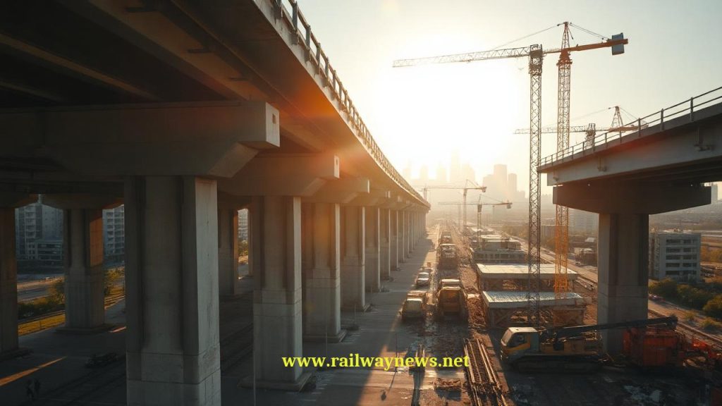
⚡ In Brief: Metrolinx has released drone imagery showing the northern segment of Toronto’s Ontario Line rising above ground, with bridge piers, guideway structures and station foundations now visible.
TORONTO, CANADA – Metrolinx has released a new set of drone images documenting construction progress on the northern elevated and at-grade section of the Ontario Line, a 15.6‑km driverless metro that will add 15 stations to Toronto’s rapid‑transit network. The imagery, made public via a press release, shows bridge columns, guideway spans and early station structures taking shape across the city’s northeast. Separately, Metrolinx’s Skills2Advance programme has graduated a cohort of workers who are now deployed on Ontario Line construction sites, helping to meet skilled‑labour demand.
What Is the Full Scope of This Project?
The Ontario Line is a C$10.9 billion fully automated metro line stretching from Exhibition Place in the southwest to the Ontario Science Centre in the northeast. The northern section, which the drone images capture, runs largely above ground on a new elevated guideway through Thorncliffe Park and Flemingdon Park, before entering a short tunnel to the terminus station at Science Centre. In parallel, Metrolinx’s Skills2Advance initiative has trained local graduates in heavy‑civil construction trades, placing them directly onto Ontario Line sites—an element not mentioned in the drone‑imagery release but confirmed by the agency and its partners (Source: Ontario Construction News, 2025). Overall project delivery is split into multiple design‑build packages; the northern segment is being built by the Pape North Connect consortium (Aecon, Dragados, Ghella) under a fixed‑price contract whose specific value has not been separately disclosed.
Key Project Data
| Parameter | Value |
|---|---|
| Project / Contract Name | Ontario Line (northern elevated segment) |
| Total Value | Overall line budget C$10.9 billion; north section contract value not disclosed |
| Parties Involved | Owner: Metrolinx, Infrastructure Ontario; Contractor: Pape North Connect consortium (Aecon, Dragados, Ghella); Skills2Advance programme managed by Metrolinx and community partners |
| Timeline / Completion | Northern guideway and station structures visibly advancing in 2025; full Ontario Line revenue service targeted for 2031 |
| Country / Corridor | Toronto, Ontario, Canada |
How Does This Compare to Similar Projects?
The Ontario Line’s use of elevated guideways on the north side mirrors the modernisation approach seen in other North American transit expansions, though it is a greenfield line rather than a rehabilitation. The recently completed $2.1 billion Chicago Red & Purple Modernisation (RPM) Phase One, delivered by a Fluor‑Walsh joint venture under a progressive design‑build contract, also used drone surveys and advanced construction technologies to keep an existing corridor operational while adding new guideways (Source: Construction Dive, 2025). Chicago’s effort reached substantial completion in 2025, while Toronto’s overall Ontario Line is larger in scale and budget—C$10.9 billion for a full new line versus $2.1 billion for upgrading and partially rebuilding an existing corridor. In the broader market, metro investment trends remain strong: Eurostar estimates that robust capacity decisions in the UK could lift the company’s annual economic contribution from £2 billion and 23,000 jobs in 2025 to £2.8 billion and 40,000 jobs by 2035, demonstrating how urban rail projects can catalyse employment far beyond the construction phase (Source: Global Railway Review, 2026).
Editor’s Analysis
Metrolinx’s decision to share drone imagery of the northern Ontario Line segment marks a continuation of the open‑construction communications strategy that has helped maintain public acceptance during disruptive city‑centre works. The parallel deployment of Skills2Advance graduates points to a deliberate workforce‑pipeline model that could prove replicable for other Canadian infrastructure agencies facing skilled‑labour constraints. Meanwhile, the comparison with Chicago’s RPM project suggests that progressive‑design‑build contracts—used for both the Ontario Line’s elevated guideway package and the Chicago red line upgrade—are becoming the preferred mechanism for managing schedule risk on complex urban rail undertakings (Source: Construction Dive, 2025). With Metrolinx yet to disclose milestone completion dates for the northern section, industry observers will watch whether the consortium can maintain the current pace and keep the overall 2031 opening target within the established budget.
FAQ
Q: When is the Ontario Line expected to open?
A: Metrolinx targets 2031 for the start of revenue service on the full 15.6‑km line, though no intermediate opening dates have been confirmed for the northern segment.
Q: How many stations will the Ontario Line have and where does the northern section run?
A: The Ontario Line will include 15 stations; the northern portion serves the Thorncliffe Park and Flemingdon Park neighbourhoods before terminating at the Ontario Science Centre, with stops at Flemingdon Park, Thorncliffe Park and Science Centre stations.
Q: What is the total cost of the Ontario Line and who is paying for it?
A: The project is budgeted at C$10.9 billion, jointly funded by the Government of Ontario, the Government of Canada and the City of Toronto through Metrolinx and Infrastructure Ontario.

Railway infrastructure, rolling stock and transport technologies specialist focused on global rail industry developments, high-speed rail systems, signaling technologies and freight transportation. Covering railway investments, public transport modernization, rail operations and international mobility projects across Europe, Asia and North America.
RELATED POSTS
October 8, 2026 1:15 pm
Alstom secured a €1bn contract to build 13 automated trains,...
October 4, 2026 5:14 pm
Alstom secured a CA$4.7 billion order from VIA Rail Canada...
October 5, 2026 6:12 pm
AECOM and Jacobs secured a contract in September 2026 to...
October 1, 2026 12:13 am
Illinois approved $1.5 billion annually for the Northern Illinois Transit...
October 4, 2026 11:08 pm
Sound Transit confirmed the September 30 opening of Seattle Pinehurst...

October 5, 2026 1:13 pm
New York MTA confirmed a late 2026 DEIS release for...